The Most Dangerous Roads and Intersections in Dayton, Ohio
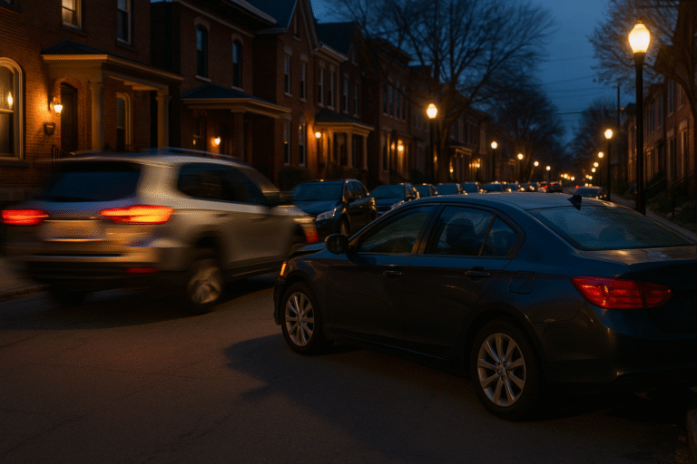
Dayton traffic has a personality all its own. Anyone who has driven through Montgomery County for more than a few days knows exactly what I mean. Between the older road layouts, commuter traffic flowing in from every direction, constant construction somewhere, and a good mix of distracted drivers, it’s no surprise that certain roads and intersections here see far more crashes than others. Together, we will explore the most dangerous roads and intersections in Dayton, Ohio.
When you zoom out and look at the crash maps for the Dayton metro area, patterns start to jump out immediately. Some intersections are magnets for fender-benders. Others consistently produce higher-speed collisions, serious injuries, and major backups. And in a handful of trouble spots, it feels like everyone in Dayton has either been in a crash there or knows someone who has.
This guide breaks down the roads and intersections in the Dayton area that consistently rank as the most dangerous. Not the sensationalized “top 10 lists” you sometimes see online — but a practical, local, data-backed look at where crashes actually happen, why they happen, and what drivers need to know to stay safe.
Why Certain Dayton Roads Are More Dangerous Than Others
Dayton, like a lot of midwestern cities, grew in waves. Older neighborhoods have tight intersections and short signals. Suburban areas were built around higher speeds and wider roads. And then there’s the constant growth of the Miami Valley region, which pushes more vehicles through roads that weren’t designed for today’s traffic volume.
Several factors come together to make certain areas significantly riskier than others:
- Heavy commuter traffic: Dayton sits at a crossroads of major highways, bringing in workers from Greene, Miami, Montgomery, Clark, and Warren counties every single day.
- High-speed corridors meeting low-speed neighborhoods: Sudden changes in speed limits and traffic flow lead to abrupt braking and higher crash rates.
- Complex intersection designs: Offset roads, double turn lanes, and older traffic patterns can confuse or frustrate drivers.
- Distracted driving: One of the biggest contributors to crashes — especially rear-end collisions at signals.
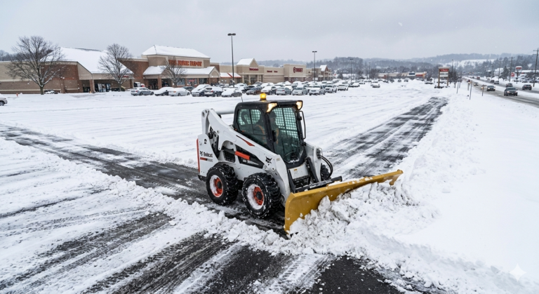
- Weather swings: Rain, snow, ice, fog, and even early-morning sun glare are major factors in Dayton collisions.
Before digging into the individual locations, it helps to understand the broader traffic dynamics of Dayton and Montgomery County. It’s one thing to know that an intersection is dangerous; it’s another to understand why. Lastly, it may not be bad to avoid the most dangerous roads and intersections in Dayton as much as possible.
Dayton’s Traffic Flow: A Quick Breakdown
Dayton has a unique mix of road types. It’s not like Columbus, where most of the traffic funnels along a handful of big boxy highways. It’s not like Cincinnati, where huge hills and tight downtown streets define the driving experience. The Dayton metro area blends old manufacturing neighborhoods, wide suburban corridors, and high-speed interstates — all within a few miles of each other.
Here’s how Montgomery County’s traffic character breaks down:
1. Interstate Corridors (I-75, I-70, US-35)
These serve as the main arteries for commuters, truck traffic, and anyone traveling through Ohio. When crashes happen here, they’re usually higher-speed and involve multiple vehicles. I-75 through downtown Dayton is especially notorious for sudden congestion, unpredictable merging, and stop-and-go traffic near the interchanges.
2. Major Suburban Thoroughfares
Areas like Kettering, Beavercreek, Huber Heights, and Centerville depend heavily on multi-lane, 35–45 mph roads that pass through thousands of businesses. Intersections here see tons of turning traffic, frequent braking, and drivers trying to beat yellow lights.
3. Older Urban Neighborhood Streets
Many of Dayton’s historic neighborhoods were built long before modern traffic standards existed, and their road designs still reflect the transportation needs of the early and mid-20th century. These areas typically feature narrow lanes, closely spaced intersections, and residential streets that were never intended to accommodate today’s vehicle sizes or traffic volumes. As a result, they present a series of structural challenges that contribute to elevated crash rates, particularly during periods of heavy local activity.
Visibility is one of the most significant issues on these older streets. Mature trees, architectural features positioned close to the roadway, and rows of on-street parking frequently reduce drivers’ ability to detect approaching vehicles, pedestrians, or cyclists. Many intersections have limited sightlines caused by the orientation of the streets themselves, and drivers often must edge forward into the intersection before they can safely determine whether the path is clear. This dynamic contributes to a high incidence of turning collisions and angle crashes in neighborhoods such as Belmont, St. Anne’s Hill, and the South Park Historic District.
In addition, the narrowness of many residential streets increases the likelihood of sideswipe collisions, especially when larger vehicles attempt to pass one another or maneuver around parked cars. Delivery trucks, school buses, and modern SUVs occupy significantly more roadway width than the vehicles these neighborhoods were originally designed for. In areas with high parking density—common in older districts with limited driveway availability—drivers often find themselves weaving between parked cars and oncoming traffic, creating conditions ripe for low-speed but frequent accidents.
Pedestrian and cyclist activity also plays a major role in the collision profile of Dayton’s historic areas. These neighborhoods have more foot traffic than many suburban zones, in part because residents rely on walkability as a core feature of community life. Children walking to school, families using neighborhood parks, and pedestrians accessing local shops all contribute to increased interaction between vehicles and individuals on foot. Cyclists navigating narrow lanes must share space with drivers who may not anticipate their presence, particularly at intersections where drivers must make quick decisions based on limited visibility.
Finally, the age of the infrastructure in these neighborhoods can influence crash risk. Some roads exhibit uneven pavement, poor drainage, or deteriorating lane markings, all of which can impair a driver’s ability to navigate safely. During winter months, shaded streets may retain ice long after major corridors have cleared, contributing to skidding and loss-of-control incidents. When taken together, these factors demonstrate how Dayton’s historic charm comes with structural traffic challenges that require patience, awareness, and reduced speeds to navigate safely.
4. School and Park Zones
School and park zones throughout Montgomery County consistently rank among the highest-risk traffic environments because they combine heavy pedestrian activity, inconsistent driver behavior, and recurring congestion tied to predictable daily schedules. These areas are particularly vulnerable during morning drop-off and afternoon pick-up periods, when drivers often rush, multitask, or make impulsive decisions in an effort to save time. Even in suburban communities such as Kettering, Oakwood, and Centerville—where road design is more modern—collision rates routinely rise during school commuting hours. In older urban neighborhoods, these challenges intensify due to the density of surrounding development and the more complex mix of driver familiarity.
Dayton’s school zones demonstrate an especially broad range of risks. They serve not only local families but also commuters, transit users, and individuals passing between neighborhoods. This variability in who travels through a school zone adds to the danger. Some drivers know the patterns and anticipate the stops, queues, and crossing guards. Others encounter the environment unexpectedly and react too slowly to signage, flashing beacons, or student movement. When these behavioral differences combine with narrow streets, limited sightlines, or multi-lane corridors, the likelihood of sudden stops, lane shifts, improper turns, or pedestrian conflicts increases significantly.
These issues are magnified dramatically on the Salem Avenue corridor near Richard Allen Preparatory School at 627 Salem Avenue—an area that has become one of Dayton’s most consistently hazardous school-zone locations. Salem Avenue is already known for aggressive driving patterns, frequent speeding, and motorists who display limited regard for right-of-way rules, particularly during high-traffic periods. When these behavioral tendencies meet a school zone that lacks uniform traffic control, the risk to students, staff, parents, and passing motorists rises sharply.
High-Risk Conditions at Richard Allen (627 Salem Ave)
The primary danger in this area stems from the interaction between the roadway’s physical design and the human factors that influence daily traffic flow. Salem Avenue is a wide, multi-lane urban thoroughfare with a long, straight visual corridor. This design unintentionally encourages higher speeds because drivers perceive the roadway as open, predictable, and safe to accelerate through. In reality, this section requires heightened caution due to the concentration of turning vehicles, pedestrians, and stop-and-go patterns associated with school operations.
The most significant safety concern, however, is the method by which traffic is directed during pick-up and drop-off times. Rather than using trained law enforcement officers or certified traffic controllers, the school relies on in-house personnel wearing reflective vests to manage vehicle flow. While well-intentioned, these individuals often lack the professional training needed to safely control a multi-lane arterial roadway with high-speed traffic. Their hand signals, gestures, and instructions can vary from day to day, creating confusion among drivers—especially those who are not familiar with the school’s procedures.
This inconsistency has several consequences. Drivers may receive unclear or conflicting directions, leading to hesitation, abrupt stops, or sudden lane changes. Others may disregard the signals entirely if they perceive the person directing traffic as unofficial or lacking authority. In a corridor already characterized by reckless driving behaviors—including speeding, red-light running, and aggressive lane switching—these inconsistencies substantially increase collision risk. Even a moment of miscommunication can place students crossing the street, parents pulling into the lot, and motorists traveling through the corridor in immediate danger.
Additionally, the lack of uniform traffic control creates significant unpredictability for passing drivers. Some school personnel step into the roadway to halt traffic in ways that differ from accepted law enforcement procedures. Others rely on improvised gestures that are difficult for drivers in multiple lanes to interpret. When drivers in one lane stop suddenly while drivers in adjacent lanes continue through at full speed, the potential for side-impact or rear-end collisions increases sharply. The problem becomes even more pronounced during winter months, when visibility is reduced and pavement conditions fluctuate.
Given these challenges, the safest and most effective solution would be for the school to partner with the Dayton Police Department or employ certified, professionally trained traffic controllers. The presence of marked police vehicles with activated lights would create a level of visibility, authority, and consistency that in-house personnel simply cannot provide. This additional layer of formal traffic control would immediately reduce speeding, improve lane discipline, and ensure that all drivers approaching the school zone receive signals they recognize and respect.
Until such measures are implemented, the Salem Avenue school zone will continue to pose an elevated risk. The combination of aggressive driving patterns, large traffic volumes, and improvised traffic control creates a scenario in which minor errors can have major consequences—particularly for the students and families who rely on this corridor twice each day.
Common Crash Types in the Dayton Area
Understanding crash types helps explain why certain intersections show up again and again in Dayton’s safety data. For example:
- Rear-end collisions: Extremely common on major suburban roads and highway exit ramps.
- Angle collisions (T-bone crashes): Frequent at high-speed intersections with fast yellow lights.
- Side-swipe crashes: Common on multi-lane roads, especially near merging points.
- Left-turn crashes: One of the most widespread crash types in Montgomery County — especially where traffic signals don’t have dedicated green arrows.
- Single-vehicle crashes: Often weather-related, happening on I-75, I-70, and rural stretches of road.
This is important: the most dangerous roads and intersections in Dayton aren’t always the ones with the most cars. They’re the intersections where driver behavior, road design, and traffic volume collide.
If you drive these corridors every day—whether you’re commuting on I-75, cutting across Woodman, or navigating Wilmington Pike during rush hour—it’s worth making sure your auto policy is built for real-world Dayton risk, not just the legal minimums. You can review coverage options and liability limits through our main Dayton and Ohio auto insurance page.
Why Drivers in Dayton Face Unique Challenges
Dayton drivers deal with a set of factors that don’t affect every Ohio city. People who move here from Columbus or Cincinnati often comment that the driving experience here feels “different” — and not always in a good way.
Here’s why:
1. Constant Merging and Exit Activity
Dayton’s interstates are tight. On I-75 especially, there are short merge lanes, closely spaced exits, and a lot of vehicles trying to change lanes at the same time. This creates situations where one driver taps the brakes and four cars back get involved in a crash.
2. High Number of Older Road Layouts
Many Dayton intersections were designed decades ago, long before traffic levels looked like they do today. Some neighborhoods still have intersections with offset left turns, small medians, or limited visibility.
3. High Student Driver Population
Between Wright State University, the University of Dayton, Sinclair Community College, and multiple trade schools, Montgomery County sees a high number of inexperienced drivers navigating busy roads for the first time.
4. Distracted Drivers
Texting and driving is a major issue. It’s one of the top contributors to rear-end and angle crashes throughout the Miami Valley area.
5. Weather Extremes
Dayton gets everything: heavy snow, ice, rainstorms, thick fog, and blazing sun glare over the Great Miami River. Intersections that are already tricky become significantly more dangerous in certain conditions.
What Makes an Intersection “Dangerous” in Montgomery County?
When the Ohio Department of Transportation (ODOT), Montgomery County engineers, and local police departments analyze crash data, they look for specific patterns. It’s not just about the number of crashes — it’s about the type and severity.
The intersections and road segments that repeatedly show up tend to share these traits:
- High-speed cross traffic with long yellow lights that encourage drivers to push through.
- Multiple turning movements happening simultaneously.
- Poor visibility due to hills, curves, or nearby buildings.
- Heavy turning traffic into shopping centers, plazas, or neighborhood entrances.
- Short stacking distance between the stop bar and the nearest driveway.
- Stop-and-go patterns caused by irregular signal timing.
- High congestion during peak hours and significantly different flow during off-peak times.
Now that you’ve got the context — the traffic patterns, the road behavior, the crash dynamics — we can break down the specific Dayton roads and intersections that consistently show up as the most dangerous year after year.
These locations represent a mix of high-speed cross streets, heavy crowds, confusing lane layouts, and older road design. Commuters know them. Delivery drivers know them. Police know them. Insurance companies definitely know them.
Here’s where Dayton drivers need to pay the most attention.
The Most Dangerous Intersections and Road Segments in Dayton, Ohio
Dayton’s road network produces consistent collision patterns, and certain intersections show elevated crash frequency year after year. These locations combine high speeds, heavy commuter pressure, complex geometry, and environmental factors that make them far more susceptible to collisions than typical intersections across Ohio. The following sections break down these areas in detail, explaining not only where the highest-risk zones are located, but also why these specific sections of roadway continue to challenge drivers throughout Montgomery County.
Dayton’s Most Dangerous Intersections — Ranked (1–10)
| Rank | Intersection | Crashes | Min/Mod Injuries |
Serious Injuries |
Fatalities | C.I.S. | Local Notes |
|---|---|---|---|---|---|---|---|
| 1 | James H. McGee Blvd & 3rd St | 50 | 32 | 13 | 0 | 151.92 | High-speed turning; congestion. |
| 2 | Philadelphia Dr & Salem Ave | 45 | 46 | 4 | 0 | 146.16 | Aggressive corridor; speeding. |
| 3 | Germantown St & Broadway St | 35 | 30 | 1 | 1 | 100.8 | Narrow layout; pedestrian activity. |
| 4 | Gettysburg Ave & James H. McGee Blvd | 43 | 26 | 3 | 0 | 97.92 | Left-turn conflicts; inconsistent speed. |
| 5 | James H. McGee Blvd & Philadelphia Dr | 32 | 21 | 4 | 1 | 90 | Older geometry; visibility issues. |
| 6 | Siebenthaler Ave & Philadelphia Dr | 32 | 18 | 6 | 0 | 83.52 | Aging lanes; heavy turning traffic. |
| 7 | Gettysburg Ave & Free Pike | 24 | 22 | 3 | 1 | 82.8 | Bus stop congestion; quick signals. |
| 8 | Ludlow St & Washington St | 26 | 15 | 7 | 0 | 76.32 | Downtown pedestrians; tight turns. |
| 9 | Main St & Siebenthaler Ave | 27 | 21 | 1 | 0 | 68.4 | Peak-hour congestion; multi-lane conflict. |
| 10 | Philadelphia Dr & Cornell Dr | 19 | 14 | 3 | 1 | 61.92 | Residential mix; unpredictable flow. |
Sources: Elk & Elk Crash Index Score (2024), ODOT crash summaries, and combined local traffic analysis. While this data wasn’t used to create The Most Dangerous Roads and Intersections in Dayton, their data supports findings.
I-75 Through Downtown Dayton
I-75 through the downtown corridor remains one of the most consistently hazardous stretches of highway in the state. Despite periodic reconstruction projects intended to improve flow, the fundamental design of this corridor creates a convergence of traffic patterns that elevate crash risk. Short weaving distances, closely spaced on-ramps and off-ramps, abrupt lane reductions, and a high percentage of commercial truck traffic all contribute to persistent collision activity.
The segment near the US-35 interchange is particularly problematic. As drivers transition from high-speed interstate conditions to the complex system of flyovers and ramp movements, sudden braking becomes common. During peak traffic hours, a single vehicle hesitating before a merge can lead to a cascading series of brake lights, frequently resulting in multi-vehicle rear-end collisions. The elevated structure of the highway, including concrete medians and limited shoulder space, leaves little room for driver error. When a crash does occur, traffic quickly backs up, creating further opportunities for secondary collisions.
In winter months, this section becomes even more dangerous. Cold air tends to settle along the Great Miami River valley, creating patches of black ice on bridges and elevated surfaces. Drivers who assume the pavement is merely wet often lose control as they cross. The combination of speed, limited escape routes, and heavy volume explains why I-75 through downtown Dayton consistently appears in traffic safety reports.
US-35 Between Downtown and Beavercreek
US-35 is one of the primary east–west corridors for commuters traveling between Dayton, Riverside, Beavercreek, and Wright-Patterson Air Force Base. The stretch between the Steve Whalen Boulevard interchange and the Fairfield Road exit is especially troublesome. The roadway shifts from an urban expressway to a more suburban limited-access highway, and the changing traffic dynamics can catch drivers off guard.
Crashes on this stretch often involve lane changes made at high speed, especially near the Smithville Road and Woodman Drive interchanges. During morning and evening rush hours, traffic often compresses quickly as drivers attempt to position themselves for exit ramps. Sudden slowdowns are common, and distracted drivers frequently fail to brake in time. Angle crashes and side-swipes also occur when drivers attempt to cut across lanes to avoid missing an exit.
The presence of Wright-Patterson Air Force Base personnel adds another layer of complexity. Many drivers on this route are not local to Dayton and may be unfamiliar with the road’s layout or the timing of congestion waves. When combined with seasonal factors—particularly heavy fog that settles on the eastern side of the metro area—this corridor produces a substantial number of serious collisions each year.
State Route 48 (Far Hills Avenue) in Kettering and Oakwood
Far Hills Avenue presents a very different kind of risk. Unlike the high-speed interstates, the danger here comes from frequent stopping, turning, and pedestrian activity in dense business districts. The roadway passes directly through some of the most trafficked shopping, dining, and residential zones in Oakwood and Kettering, and nearly every block contains multiple access points to parking lots and side streets.
The intersections at Dorothy Lane, Stroop Road, and Oakwood Avenue are especially prone to collisions. These areas experience a constant mix of left turns across oncoming traffic, vehicles pulling out of narrow driveways, and drivers slowing unexpectedly when searching for businesses or residences. The older road geometry—with limited center turn bays and minimal buffering between travel lanes and curb cuts—creates a situation where routine driving maneuvers can lead to conflict points.
Additionally, pedestrian activity is significant along this corridor, particularly near schools, churches, and shopping centers. During morning and afternoon periods, foot traffic mixes with heavy vehicle flow, and reduced visibility due to parked cars or tree-lined sidewalks can make it difficult for drivers to react in time. Even experienced local drivers recognize Far Hills Avenue as a corridor where heightened caution is necessary.
North Main Street (State Route 48) Through Harrison Township and North Dayton
While State Route 48 in Oakwood and Kettering poses challenges due to its density, the northern stretch through Harrison Township has a very different crash profile. This area contains multiple high-speed segments intersecting with older cross streets, many of which have poor visibility or minimal turn lanes. Drivers often attempt left turns across fast-moving traffic, resulting in angle collisions and multi-vehicle pile-ups.
Intersections near Shoup Mill Road, Turner Road, and Philadelphia Drive consistently show elevated crash rates. The problem is compounded by inconsistent lighting in certain segments and multiple lanes of travel that make it difficult for drivers to judge oncoming traffic. When one vehicle in the far lane slows to allow a turning car through, the driver turning left may not see that vehicles in adjacent lanes are continuing at full speed. These types of crashes frequently produce serious injuries.
Woodman Drive in Riverside, Dayton, and Kettering
Woodman Drive is among the most consistently hazardous corridors in Montgomery County. It serves as a major connector between US-35, suburban neighborhoods, commercial zones, and large residential areas. The intersections at Linden Avenue, Patterson Road, and Dorothy Lane stand out as particularly high-risk zones.
Linden Avenue is one of the most frequently cited problem points. The intersection carries traffic from multiple directions, including vehicles entering and exiting nearby shopping centers. Visibility can be compromised during peak hours because of the heavy volume of turning traffic and the slight elevation changes approaching the intersection. Rear-end collisions are common because drivers often accelerate quickly when they believe they have a clear path but then brake suddenly when a left-turning vehicle appears ahead.
The Woodman Drive and Dorothy Lane intersection experiences a different pattern of collisions. Here, high-speed traffic from Woodman meets the steady flow from Dorothy Lane, creating situations where drivers misjudge the timing of yellow lights. Left-turn crashes are especially common, and the multiple lanes of travel on both roads increase the likelihood of side-swipes and angle impacts. Speeding is also a notable contributor, particularly during evening hours when traffic thins but drivers maintain high velocities through the corridor.
Wilmington Pike in Kettering and Sugarcreek Township
Wilmington Pike is one of the busiest suburban corridors in the Dayton area, and the intersection patterns reflect that reality. The area near I-675, particularly between Stroop Road and Feedwire Road, consistently records a high volume of collisions. Drivers who exit I-675 onto Wilmington Pike must immediately navigate a dense commercial zone containing restaurants, shops, and high-traffic parking lots. This abrupt transition from highway conditions to congested suburban streets leads to frequent rear-end collisions and sudden lane-change accidents.
Further south, the intersections near Whipp Road and Feedwire Road experience significant congestion during retail peak hours. The density of shopping centers and business entrances creates numerous conflict points, especially when drivers slow suddenly to make turns into narrow parking lot entrances. Crashes in this corridor are often tied to inattentive driving, last-minute decisions to turn, and left turns made across multiple lanes of traffic.
Alex-Bell Road (State Route 725) in West Carrollton and Miamisburg
Alex-Bell Road serves as a major east–west connector for several communities in southern Montgomery County, and its design presents several unique challenges. The intersections near Springboro Pike (State Route 741) and the I-75 interchange routinely display elevated crash rates. These areas combine heavy commuter traffic with vehicles entering and exiting commercial zones, creating unpredictable slowdowns and sudden braking events.
During peak hours, the bottleneck created near the Dayton Mall area contributes to congestion and crash risk. Drivers frequently attempt to make left turns across oncoming traffic, and the wide multi-lane structure of the roadway makes it difficult to anticipate the actions of drivers in adjacent lanes. Rear-end collisions are the most common crash type in this corridor, though angle collisions also occur at a higher frequency than average. This is why it has made the list as one of the most dangerous roads and intersections in Dayton.
Dorothy Lane in Kettering
Dorothy Lane crosses through some of the busiest travel zones in Kettering, with major intersections at Wilmington Pike, Far Hills Avenue, and Woodman Drive. The combination of steady residential traffic and the presence of multiple retail centers creates heavy turning movement throughout the day. Drivers often make sudden stops when searching for specific businesses or when attempting to merge into narrow turn lanes.
One of the persistent concerns along Dorothy Lane is the short distance between traffic signals in certain segments, which can cause stacking and driver frustration. When drivers attempt to accelerate to reach the next light before it changes, yellow-light-related collisions become common. Weather-related crashes also occur frequently here due to elevation changes that can produce slick conditions during winter months.
Shroyer Road in Oakwood and Kettering
Shroyer Road may not have the traffic volume of some of Dayton’s largest corridors, but the crash patterns along this roadway illustrate the challenges of navigating older suburban infrastructure. The intersections at Dorothy Lane and Patterson Road experience significant congestion during school hours due to their proximity to educational facilities. Turning movements, limited visibility during peak pedestrian activity, and closely spaced driveways contribute to frequent collisions.
The steep grade changes along certain sections of Shroyer Road reduce sightlines, making it difficult for drivers to anticipate stopped traffic or slowing vehicles ahead. Though most crashes here are not severe, the frequency of fender-benders and angle collisions places Shroyer Road on the list of Dayton’s more troublesome routes.
State Route 4 Near Stanley Avenue and Harshman Road
State Route 4 provides direct access to industrial areas, residential neighborhoods, and major employment centers, including Wright-Patterson Air Force Base. The area near Stanley Avenue and Harshman Road consistently experiences elevated crash activity. Drivers entering and exiting SR-4 often face short merge distances and rapidly changing traffic speeds. The roadway’s curvature in this area further complicates visibility.
Crashes in this corridor often involve lane changes and merging conflicts, especially during early morning hours when commuters converge on the industrial and military facilities. The presence of commercial trucks also plays a role, as their reduced acceleration and braking capabilities amplify the risks associated with sudden slowdowns or merging difficulties.
Environmental and Seasonal Factors Affecting Dayton Traffic Safety
Several environmental conditions contribute to collision risk throughout Dayton and Montgomery County. Winter storms frequently create dangerous road conditions on elevated surfaces such as bridges and overpasses. Even light snow can cause hazardous conditions on interstates and multi-lane suburban corridors, especially when traffic quickly compacts the snow into ice.
Fog is another recurring challenge in the Dayton area, particularly in low-lying areas near rivers and creeks. Thick fog during early morning hours has produced multiple multi-vehicle crashes on routes such as US-35, I-75, and I-675. Visibility can drop suddenly, leading drivers to overreact or brake abruptly.
Rainfall contributes significantly to crash rates as well. Dayton’s aging drainage systems occasionally struggle during heavy storms, producing standing water in low points on major roads. Hydroplaning incidents are most common on the interstates and on wide suburban corridors with high-speed travel lanes. Drivers unfamiliar with the area often do not anticipate these pockets of water, increasing the risk of losing control.
How Dangerous Intersections Influence Auto Insurance Rates in Dayton
Insurance companies analyze regional collision data when determining rates for drivers. Though insurers do not charge more for living near a specific intersection, they do examine broader crash patterns across ZIP codes. Areas with elevated crash frequency—such as the corridors surrounding Woodman Drive, Far Hills Avenue, and I-75 downtown—generally experience higher average insurance premiums.
For drivers who frequently travel through these high-risk corridors, maintaining proper coverage is essential. The combination of complex traffic patterns, distracted-driving trends, and seasonal weather volatility means that even cautious drivers may be exposed to elevated collision risk. Residents in Montgomery County often benefit from working with an agent who understands these localized risk factors and can match them with carriers that evaluate Dayton’s traffic environment fairly.
For drivers who wish to review their coverage options, additional information is available through the main auto insurance page at Ingram Insurance Auto, where policy guidance and personalized assistance are available.
Improving Safety on Dayton Roads
Efforts to improve traffic safety in Montgomery County continue to evolve. Local municipalities and ODOT regularly study crash reports to identify patterns and propose infrastructure adjustments. Recent years have seen increased implementation of dedicated turn lanes, improved traffic signal timing, and redesigned intersections intended to reduce conflict points.
Public awareness also plays a role. Drivers who understand the risks associated with specific intersections are better equipped to anticipate hazards. Whether it’s approaching a crowded commercial zone like Wilmington Pike, navigating the complex interchanges near downtown Dayton, or traveling through older residential areas with limited visibility, informed decision-making can reduce collision risk significantly.
Working with a local independent agent who understands these patterns can also help you match coverage to the actual risks you face on the roads you drive every day. In the Miami Valley, there are major differences between buying a policy blindly online and working with someone who knows the history of corridors like Salem, Woodman, and Far Hills. We explore those differences in more detail in our article Why Everyone in the Miami Valley Should Work with an Independent Insurance Agent.
As Dayton continues to grow and redevelop, traffic patterns will adjust accordingly. Monitoring these changes and understanding how they influence local road safety will help residents stay prepared and protected while navigating Montgomery County roadways. The goal is to increase safety so the most dangerous roads and intersections in Dayton are no longer a danger.
Related Articles to The Most Dangerous Roads and Intersections in Dayton, Ohio that You May Find Helpful
Driving, Auto, and Local Dayton Topics
- Why Every Dayton Renter Needs Insurance — and How Bundling Auto Can Save You Money
- 10 Best Coffee Shops to Work From in Dayton, Ohio
- How Gem City Market Is Changing West Dayton
Dayton & Montgomery County Home Insurance Guides
- What Dayton Homeowners Need to Know About Storm Damage Coverage
- What Dayton Homeowners Should Know Before Switching Insurance in 2025
- What Dayton Homeowners Should Know About Sewer, Drain, and Water-Backup Coverage
- Vacant Homes in Dayton: Navigating the Hidden Insurance Risks
- Dayton Homeowners Insurance: Protecting Your Investment
- Kettering, Ohio Home Insurance: Balancing Old Homes and Modern Risks
- Centerville, Ohio Homeowners Insurance: Neighborhood-by-Neighborhood Guide
Ohio-Wide Home Insurance Education
- 5 Common Home Insurance Mistakes Ohio Homeowners Make
- Understanding Home Insurance Coverage in Ohio
- Insuring Million-Dollar Homes in Dayton’s Premier Suburbs
- Ohio’s Housing Dilemma: Market Value vs. Replacement Cost
- Service Line Coverage in Ohio: What It Covers
- Do I Need Sewer Backup Coverage in Dayton and Centerville?
- Winterizing Your Home in Ohio: Steps to Prevent Claims
- Ohio Cost-of-Ownership 2025: Home Values, Taxes & Insurance